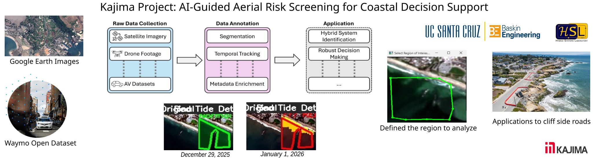
Kajima: AI-Guided Aerial Risk Screening for Coastal Decision Support
The primary motivation of this project stems from the increasing risks in coastal zones driven by climate change, erosion, and urban pressure. Early identification of surface-level hazards is crucial for environmental monitoring, disaster prevention (such as landslides or tsunamis), ecological research, and infrastructure protection. To address this, the project aims to model, predict, and control complex behaviors by developing an intelligent drone-based system that autonomously screens risk areas near ground surfaces. Using satellite imagery as a prior, AI algorithms will direct drone deployment toward locations of interest, capturing and analyzing continuous trajectory data to evaluate potential hazards like unstable terrain, illegal construction, or ecological damage. For this initial preliminary effort, the goal is to architect a framework for direct data processing software pipeline capable of obtaining trajectory data of physical events. In a longer follow-up effort, this framework will be applied to model, predict, and control complex behaviors across domains such as coastal changes, car/traffic behavior, and animal migrations.